Project Abstract
In response to the growing concerns about mangrove deforestation, recent studies have
used various remote sensing technology like satellite imagery to measure the mangrove extent. In
this work, we investigated the mangrove distribution in Northwestern Madagascar by using fine
spatial imagery with pixel size as small as 3m and compared it with the result of traditional
method based on relatively coarser Landsat data.
Mangroves are an essential biodiverse
ecosystem found along tropical and subtropical intertidal beaches, providing critical goods and
services to coastal communities, and supporting diverse organisms. However, anthropogenic
activities have caused the loss of mangroves in Madagascar, necessitating a new mapping
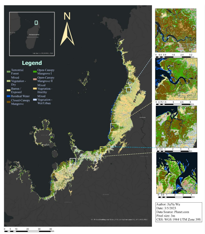
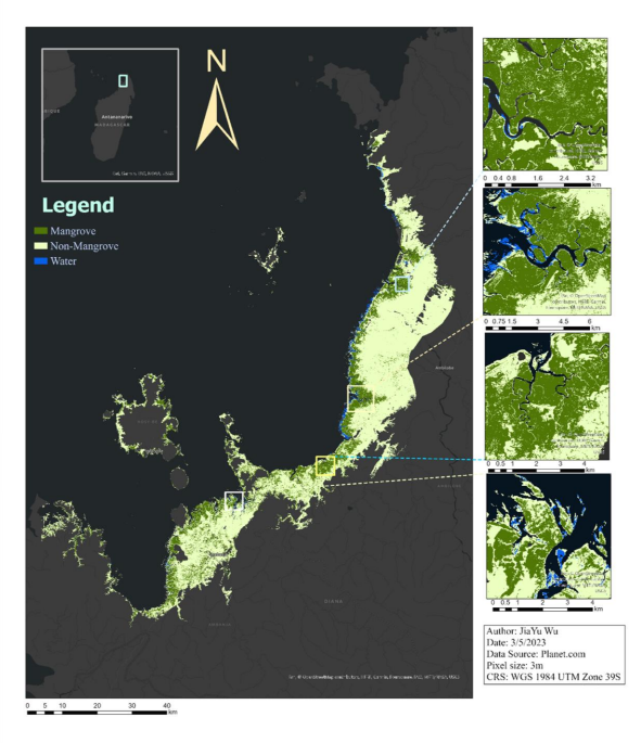
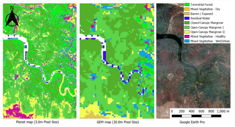
approach utilizing the fine spatial resolution map from Planet data to create a map with advanced
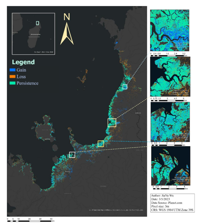
detail. The quantitative result central to this work is the new multi-date map of the Tsimipaika-Ampasindava-Ambaro Bays (TAB) from 2020 to 2022, which provides advanced detail and
direct comparison with the shift in local mangrove species.
The classification maps are based on
Random Forest and Maximum Likelihood algorithms, and all of them have an overall accuracy
of over 85%. The dynamics of mangrove forests from 2020 to 2022 are quantified, with an
12.6% loss in closed-canopy mangroves, and an 24.1% loss in open-canopy mangroves I is
overestimated. Limitations regarding the classification model are also found in this study,
including the overestimation of open canopy mangroves caused by the shadow and the seamline
in the base map. This result shows the potential of using fine resolution satellite imagery in
supervised land cover classification, and the corresponding challenges raised by the smaller pixel
size.
Find out More
StoryMap
Full Report
GitHub